
 SUMTER COUNTY
Amateur Radio Emergency Services Association (ARES)
Sumter County, Florida
Hurricane Preparation
What to Expect from a Hurricane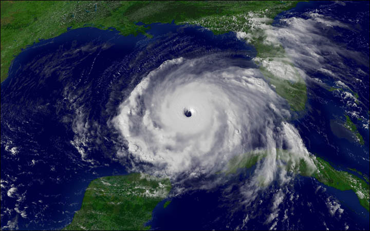
Travel Before – Turnpike/I-75 north of SR 44 (5 lanes feeding into 3 lanes) will be a mess all the way to Atlanta (at least double normal travel times).
Individual Medical Needs Support (electrical medical equipment, etc.) – Research Public Health help during storm ASAP (start with county Emergency Management website, phone).
Tornadoes – storm may spawn multiple tornadoes or none
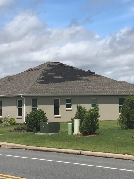
High winds – no travel when winds over 45 mph including emergency vehicles (police, fire), some roof damage may occur
-
There will be storm bands where the most intense winds and rain will occur
-
In 2017, 2018, most of the severe storm bands went west or east of The Villages, but don’t plan on that to happen again.
-
Anything left outside (furniture, tools, grills, flower pots, etc.) becomes a damaging missile to your neighbors.
-
Lots of tree debris and downed trees especially outside The Villages, some roads will be blocked
-
If getting only one side of Hurricane, winds from one direction, if you are near center, winds will switch to opposite direction at half point. Plan accordingly.
-
Mobile home, RV’s, travel trailers, sub-std housing move to storm shelters, unsafe to stay.
-
Cell towers may be damaged, service lost for your area during and days afterward..
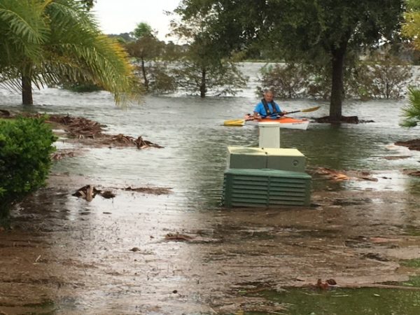
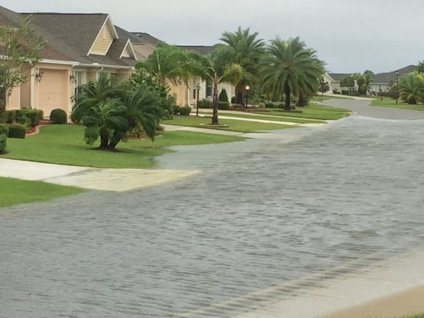
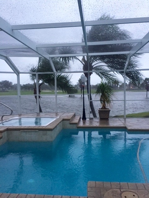
Heavy Rains – 5”+ some minor flooding, some houses impacted with 10”+ of rain ( V. of Charlotte, south of 44 unknown) Move rugs, stuff on floor higher if water has crossed your yard and getting near your doors.
-
Golf cart tunnels (Avoid going through water with a golf cart), lake borders extended, retention ponds larger, low areas, etc
Power – most of The Villages (underground service)
-
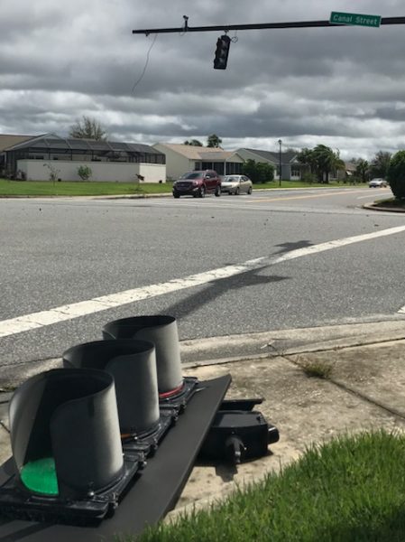
2017-Wildwood down 9 days, Lady Lake down also (power on poles), no traffic lights, limited ATM’s, businesses closed.
-
Plan for lack of power and meeting basic needs either during or after storm (generator, food storage, food types, cooking considerations)
-
Intersections with non-functioning traffic lights become 4-way stops, use caution proceed slowly as some will fail to know to correct procedure.
Fuel (gasoline, diesel, propane) – store no power, no fuel except if generator, the ability to re-stock gas stations, etc. may be limited. Emergency vehicles will get priority.
Debris – stack near curb but not in street. Clean-up will not be fast.
Help – you are limited to your resources for the first couple of days afterward. Community emphasis will be on those with medical needs and getting roads and businesses open. Don’t become a victim during this time! Be smart, think before you act, and review/restock your first aid kit now, just in case.
Neighborhood gates This gates will be removed beforehand and may not return until a week or two afterward.
 outside of this time
frame. The National Hurricane
Center (NOAA) predicts and tracks these massive storm systems, which
occur, on average, 12 times a year in the Atlantic basin.
outside of this time
frame. The National Hurricane
Center (NOAA) predicts and tracks these massive storm systems, which
occur, on average, 12 times a year in the Atlantic basin.
Of the 600 people who died in hurricanes, tropical storms and tropical depressions during the hurricane center study's 30-year time frame, 354, or 59 percent drowned or were killed from some other trauma as a result of flood

Citrus County is to our west and has the Gulf Coast for its western border; so we did not experience any storm surge. Along the border we share with Citrus County is the Withlacoochee River that flows from the Green Swamp in the southern end of Sumter County. For people living along the River and a few other places, it was a flooding event. For those outside The Villages, it was downed trees, loss of power, winds, and rain. For those in The Villages the power stayed on (underground lines, except for a few houses here and there) so it was a wind and rain event as the eye wall traveled across Citrus County. There was some street flooding in The Village of Charlotte and Orange Blossom and even though storm water got close to some houses. In the older sections of The Villages there were tree limbs down. More generally, there a few shingles blown off and some bushes and trees partially uprooted.
|
|
|
 |
 |
 |
 |
Last Update: 05/05/2019 © Copyright Sumter County ARES. All Rights Reserved.